Severe threat today, sunshine Thursday; rain returns this weekend
Few strong to severe storms today ahead of sunshine Thursday. Additional rain chances return this weekend.
A cold front moving through the area today will lead to a short-lived threat of strong to severe storms possible this afternoon and evening before we see a day of sunshine tomorrow. After tomorrow, additional rain chances return for the Halloween Weekend and continue to remain in the forecast through early next week.
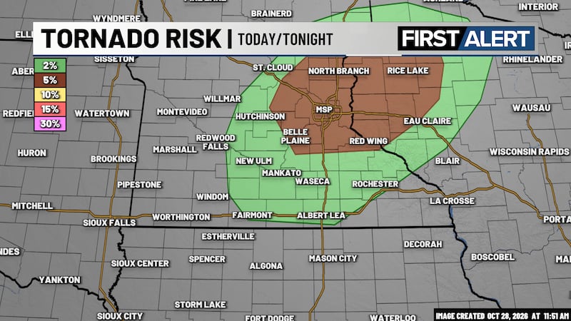
SPC Severe Risk Today

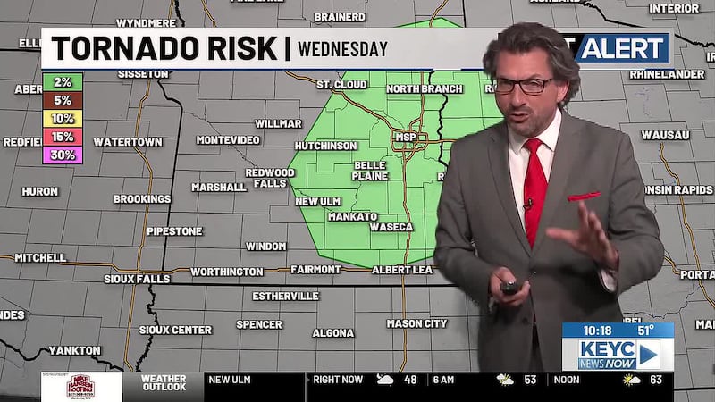
Today will be rather cloudy with foggy conditions through the morning hours. Temperatures are anticipated to top out in the upper-60s and low-70s as a cold front slowly works into the area through this afternoon. As the front moves into the area from the west, a line of showers and thunderstorms will start to develop between 3 pm and 4 pm, with a threat of strong to severe storms possible. All modes of severe weather remain possible with damaging winds, large hail, and a few tornadoes possible. The line of showers and thunderstorms will move across southern Minnesota and northern Iowa between 4 pm and 6 pm before moving into eastern Minnesota and western Wisconsin between 6 pm and 8 pm. At this point, the severe threat is no longer going to impact the southern Minnesota/northern Iowa area and we should start to see gradual clearing with mostly clear skies slowly working their way into the area. Temperatures tonight will become crisp as they drop into the low-40s by Thursday morning.
Thursday will be our only pleasant day of the week with quiet conditions and mostly sunny skies anticipated across the area. Temperatures will be relatively seasonal, topping out in the upper-50s with light winds up to 10 mph mixed in. Thursday night will remain mostly clear as temperatures drop into the upper-30s and low-40s by Friday morning.
Friday will once again become mostly cloudy by the afternoon hours with a stray shower or two possible. Temperatures will continue to hover in the upper-50s with winds up to 10 mph across the area. Friday night will remain rather cloudy with a few isolated showers possible overnight into Saturday morning as temperatures drop into the mid-40s.
Saturday is looking to remain rather cloudy with scattered showers likely throughout the day and evening. Temperatures will top out in the upper-50s and low-60s by the afternoon hours with winds up to 10 mph mixed in. Scattered showers may continue overnight into Sunday morning as temperatures drop into the low-50s.
Sunday will then start off with some lingering showers possible as cloudy skies continue to linger over the area throughout the day. Temperatures will remain in the low to mid-60s by the afternoon hours with winds reaching up to 10 mph throughout the day. Sunday night will remain mostly cloudy with a few isolated showers possible overnight as temperatures drop into the low-50s by Monday morning.
Our next system to impact the area will bring another low pressure and cold front through the area along with widespread showers and the chance of heavy rain possible. Cloudy skies are anticipated to continue Monday and Tuesday of next week with widespread showers throughout Monday into Tuesday before becoming scattered throughout Tuesday and slowly fizzling out between Tuesday night and Wednesday morning. Rain at times could be heavy around the area.
Temperatures will remain in the low-60s on Monday ahead of the cold front, but are anticipated to top out in the mid-50s by Tuesday afternoon after the cold front moves through. Overnight temperatures are anticipated to drop into the low-50s by Tuesday morning and the mid-40s by Wednesday morning.
As of right now, rain totals are projected to hover between a half an inch (0.50″) and 1.50″ by early Wednesday morning of next week.
Click here to download the KEYC News Now app or our KEYC First Alert weather app.
Copyright 2026 KEYC. All rights reserved.